


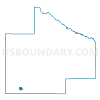
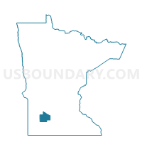
Walnut Grove Voting District, Redwood County, Minnesota
About
Outline

Summary
| Unique Area Identifier | 604009 |
| Name | Walnut Grove Voting District |
| County | Redwood County |
| State | Minnesota |
| Area (square miles) | 1.06 |
| Land Area (square miles) | 1.06 |
| Water Area (square miles) | 0.00 |
| % of Land Area | 100.00 |
| % of Water Area | 0.00 |
| Latitude of the Internal Point | 44.22489780 |
| Longtitude of the Internal Point | -95.46929240 |
Maps

Graphs
Select a template below for downloading or customizing gragh for Walnut Grove Voting District, Redwood County, Minnesota


Neighbors
Neighoring Voting District (by Name) Neighboring Voting District on the Map
- North Hero Twp. Voting District, Redwood County, MN
- Springdale Twp. Voting District, Redwood County, MN
Top 10 Neighboring County Subdivision (by Population) Neighboring County Subdivision on the Map
- Walnut Grove city, Redwood County, MN (871)
- Springdale township, Redwood County, MN (217)
- North Hero township, Redwood County, MN (161)